Fall 2012–Utah west
12 October (continued)
Desert Dampness
The storm descends on us, on and off, for the entire day. We feel very happy to have done all of our “outside” chores yesterday; Howie makes us feel very welcome, cozy, and comfortable, and we graciously accept his charity.
Heading out of Green River, we turn south on SR24 and start to travel down past the San Rafael Reef. The reef is a longitudinal ridge-like structure caused by buckling of the stratified underlayment; erosion creates distinctly different land forms than when the layers are horizontal.
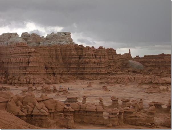 We had planned to stay at Goblin Valley SP, but they are full and anticipate being so through the weekend. No prob, plenty of BLM land around. The only issue is that the storms have made even “solid” dirt roads very questionable. I think the state of Utah probably has the monopoly on the caution sign, there are scores of these:

The light is horrible today of course, with skies dark and dismal. But then, what better backdrop for rock formations that look (supposedly) like goblins? Karin and I couldn’t really see any spooky characters, mostly just blurry round shapes; but I guess we suffer from some lack of imagination. I’ll let you be the judge.
At one point, a band of weather had just passed through, and one of the trademark formations was highlighted in the sun, with a bleak dark stormy sky behind.
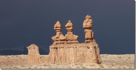
They might be goblins, but they seem to have an inclination to line up in military formation….
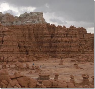
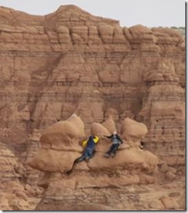
The Park is literally inundated with families and children, and the main area of “goblins” is literally a multi-colored playground, kids everywhere crawling up down and around every conceivable sandstone jungle-jim.
With the Goblin SP campground full, our plan for a camp site has to be re-visited; after some consideration, we decide for an attempt a little closer to Capitol Reef NP (to the west). A stop at a BLM station in Hanksville gives us an extremely good tip for a nice (free) area 12 miles west.
[Hanksville itself makes Green River look like Beverly Hills. Many, many abandoned houses, businesses, and farms/fields. A few survivors appear to be prosperous; for what reasons we can’t tell.]
When we locate the BLM area, we see that it is indeed “solid” graded dirt/gravel. Guess what “solid” means after a desert thunderstorm? Not so much, pretty soft. But we do find a semi-reliable spot, and we are once again delighted to find ourselves in a vast, beautiful landscape, that we (for the moment) are enjoying all to ourselves.
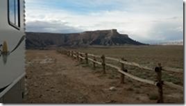
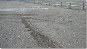
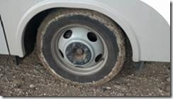

Blustery, and then some
As the dark skies roll through to the north, the night sky takes over. Stars are out in the cold, clear blackness. The back side of the cold front produces typical gusty winds – – but here, in the tumultuous terrain of this sculpted desert, those winds are played with, toyed with, by the convoluted surface of the land. Moaning, rushing currents of frontal air are operated on with mountainous scalpels, churned by razor-edged escarpments, carved up and transformed into howling, thrusting monsters, booming and whistling and groaning all around Howie, who shakes as if the earth itself is moving. The sheer force and apparent malevolence are a sham, however. Karin and I smile at each other, grinning in the sublime satisfaction of two people who are safe and comfortable – – right in their own home. Howie rocks and rolls, and after a few anxious minutes, he senses our calm security, and begins to enjoy the show right along with us.

To celebrate our invulnerability, we use Howie’s kitchen oven for the first time that we can recall. It’s a simple little propane-fired affair with a basic thermostat, and we (well, Karin actually) bake up a delicious batch of corn-bread muffins (gluten-free of course).
Yum indeed.
[Tech note: the oven burner is not loud, but noticeable; so even though it doesn’t have a “ready” indicator, we can tell that it has reached set-temperature by the quieting of the burner.]
13 October
After the Storm
We picked our camp well, and we have no problem leaving in the morning. Just 30 yards away, a couple of travelers walk over to visit the information board at the edge of the area. They are 4” taller before they leave, with heavy, gummy mud caked to their feet like epoxy. We drive away about 10 minutes later, and they are still leaning against their car, chiseling the gumbo off their shoes.
Today, we drive toward the Capitol Reef NP area, yet another region with yet another infinite set of variations in the way our earth evolves under the onslaught of water and time. As we travel SR24, we parallel the Fremont River.
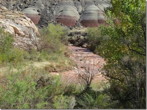
The Fremont has turned from a late-summer wandering trickle to a mid-Fall red, raging demon. The water is so turgid and full of sediment, we can easily believe a spoon would stand up in a glass of it. (In fact, in canyonland country, a “debris flow” is exactly that – – water which is so full of dirt, sand, and rocks that it acts more like wet concrete than liquid water.) We stop to grab a snapshot….
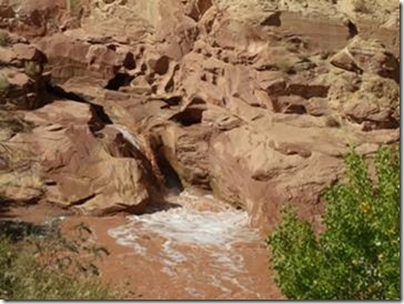
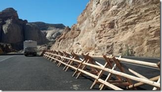
The waterfall is undercutting the road bed (left of picture). The adjacent road-side area is near collapsing, and is cordoned off.
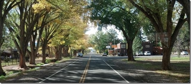 Farther west, the town of Torrey is just outside the Park boundary. Like many places in the surrounding deserts, this valley with its water supply is home to hundreds if not thousands of cottonwood trees. Desert travelers have known, from time immemorial, that the cool green leaves signal that water is nearby. This time of year, the gorgeous fall colors add to the soothing beauty. Unlike some of the towns we’ve passed through, Torrey is tidy, alive, with a sense of presence and health. We suppose that it’s likely a simple case of tourist dollars – – but it’s still pleasant regardless of why.
One thing we notice, this time a bit more-so – – Catholic churches keep a low profile in Utah :o)
Yes, it’s that low adobe affair in the center. The cross is about 30” high, hardly visible. About a mile off the highway.

Tonight, we stay at the NP campground, a pleasant, spacious affair deep in a canyon. It is interspersed liberally with – – you guessed it – – cottonwood trees in the green and gold livery of the season. It has no views, but it’s only $5 with our old-person discount card (oh, excuse my crassness, make that “Senior Inter-agency Pass”, which used to be known as the Golden Age pass, but then there was probably some argument that Gold should be Silver, and Silver should be Gray, and on and on) – – – – where was I? Oh yeah, it’s nice enough and it’s cheap. :o)
14 October
Capitol Reef
We learn lots of things today, little tidbits: the Reef is the longest “monocline” in the world, over 100 miles. A monocline is a uniform fold in the earth’s crust, causing a slope extension left-to-right in stead of high-to-low. Lay a piece of plywood on the floor, and spread a blanket across it. Then picture that the “ledge” caused by the plywood edge is thousands of feet high. The plywood represents a deep underlying segment of shifted mantle; the blanket is the overlying crust. Got that? Now add 25 million years of weathering. The folded edge gets more weathering because of the strain and cracking, so older rocks get exposed above younger, lower rocks. Almost exactly the opposite of all the typical canyon forms that we’ve seen so far.
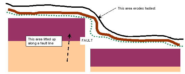
The nomenclature “reef” was first used by early explorers. Having traveled from their lands of origin by sea, they likened the huge land-obstacles they saw to the oceanic reefs which posed such hazards and obstacles to travel by ship. This one really got their attention, being over 100 miles wide. In the early days, only the Fremont River gorge afforded passage, with the huge risk of seasonal flash flooding.
Repetitive Surprises
Something it’s difficult to relate about this “canyon country” that we travel through – – it’s all “just” eroded sandstone and sedimentary strata, and Karin and I find ourselves tending to expect a same-ness from locale to locale. Quite the opposite, we actually experience a continuous series of surprising delights. It seems that, no matter how inured we might think ourselves to the sweeping saga of cliffs and rock, almost every turn in the roadway produces another smile, or gasp, or shake of the head that such beauty can so continuously re-invent itself, and in so doing, leave us happily mesmerized, mile after mile after mile. We have concluded, many times, that we will be back here again – – and again and again. There is simply no tiring of the stunning nature of this place.
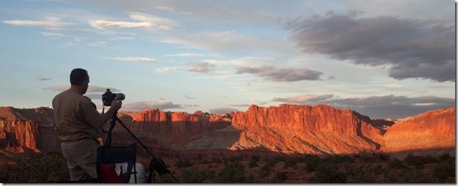
This guy was also quite impressed, and had spent the last three hours set up, photographing every change of light, cloud, and nuance that he could get. His wife was quite happy to snuggle below his line of sight, relaxing and taking it all in.
We spend the day sight-seeing, and the afternoon we do something that may puzzle some folks: we spend about an hour and a half reconnoitering camp sites. We find several possibilities, in multiple situations from cozy little cottonwood glens down in canyons or sand-washes, to lofty hill-top barren knolls with commanding views. Karin and I are of like mind in this 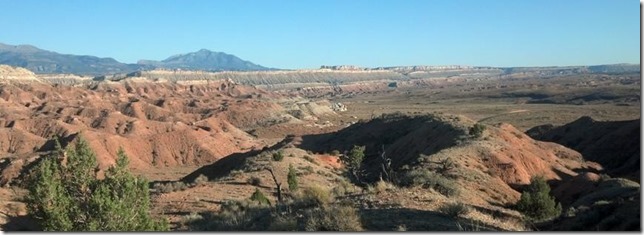 area; given a choice between a sheltered, cozy canyon or a chilly, wind-swept cliff edge, we’ll take the cliff every time.
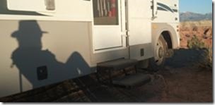
 View from below camp – – – – – – at sunset – – – – – – and fire-side
Philosophy of Vastness
So why the non-intuitive urge to brave sun and wind, to forsake shelter, just for a grand view? It’s not a simple explanation, and it’s not just the view. I can only speak for myself on this. Although Karin’s appreciation of it is no less than mine, I’m sure her words would be different.
Out in the wild, the human presence is less evident, if at all. From a mountain top or a desert escarpment, literally hundreds of square miles of land can be seen, nearly all with no fence, building, or structure. In a single sweeping glance, an enormous tract of the land can be seen pretty much as Nature created it. When I stop to absorb this, the vastness pervades my senses, and with this comes a broader sensation of – – words are so puny – – let me call it “All-ness”.
What comes to me from this is a sense of a greater Universe, something beyond the tiny lives of Man, something more of the Infinite and less of the toil of a day. And ironically, what happens to me with this connection to vastness and timelessness is, in the end, a vanishing of the individual sense of time and space, and even of self, all gently superseded by a sense of Unity, a full and peaceful appreciation of the Moment.
This “life in the Moment” is for me a rare gift, and I don’t often achieve such a state in daily life. But after all, the Here, and the Now, is, in the final analysis, all that really exists. It is all any one of us ever has in our time (our moments) on earth. To be able to connect with this is, to some extent, one of the central essences of all spiritual efforts of man. I have been fortunate to find, in such a simple and unpretentious place as the undeveloped American West, many places that help me with this connection.
So yes, we seek them out whenever we can, and we enjoy them to the fullest.
15 October
Exploring the Reef (some more)
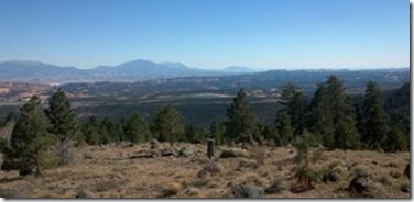
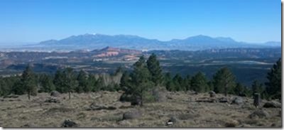
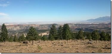
Today we thought we were leaving Capitol Reef. Little did we know what SR12 had in store for us. This unpretentious little road, with a few marked campsites, skirts the western edge of Capitol Reef and the eastern boundary of the Grand Staircase of the Escalante. At this point, the top step of the Grand Staircase is the huge mesa called Boulder Mountain, a 10,000 foot plateau with dense populations of evergreens and aspen. Winding precariously along the steep flank of the mountain, SR12 looks down and across the fantastic landscape of the Reef. Spread out below the multiple overlook points is a 60-mile stretch of the most convoluted, picturesque geology imaginable. The highway’s serpentine wanderings take it past the heavily-eroded monocline for mile after mile. It’s too bad there’s not another, more stentorian phrase for “scenic byway”, because this one puts most of the others to shame.
Here’s a (poorly) stitched-together 150-degree view:
Reaching the southerly extent of SR12 (it turns west across the Staircase area), we reach Boulder, UT and a cool little road called Burr Trail Road. It’s paved (Howie is grateful), and goes at least 40 miles deep into the Staircase and lower Reef back country.
As in most National Monument territories, Escalante has strong restrictions on off-road travel and camping. If there’s no evidence of a previous camp (typically a fire-ring), you may NOT camp, period. For the sake of keeping things fairly un-touched, new roads and camps are not encouraged. Consequently, we drive for miles and miles with not even a spur road to pull off on – – a mixed blessing. One of the sections is Long Canyon, living up to its name. It is nearly a slot canyon, very narrow and winding within 1000-foot bluffs. Very scenic but no camps.
When we emerge from Long Canyon, a broad desert valley opens before us, with undulating hills and drainages. There are a few small roads and we explore them until we find a camp. It’s not a vast overlook like last night’s, but it has its charms and we settle in for what turns out to be a cool (mid-30’s) night. Once again, we have the place to ourselves, the occasional traffic on Burr Trail Rd dies off to nothing, and the desert stillness surrounds us in its peaceful embrace.
16 October
I chose to park Howie facing west last night, and since we’re all alone we don’t even pull the drapes. This morning, we are amply rewarded with a sunrise-lit view of the last of Long Canyon bluffs, right out the front windshield.
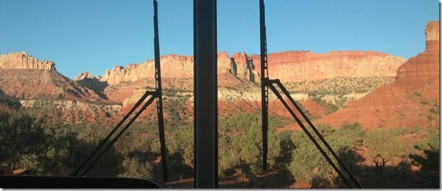
The drive back up Burr Trail Road is just as pleasant as going out, and we pass through Boulder and then west again on SR12.
Honestly, this highway is just a continuous pleasant surprise. If anyone ever asks me how to cross Utah, I’ll tell them to take SR12.
Coming west toward Escalante, the highway passes through a broad assortment of cliffs and canyons, all part of the landscape that surrounds, or is part of, the National Monument.
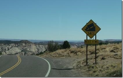 Then, the highway suddenly finds itself on a narrowing ridge of land, with sheer drops to BOTH the left and right of the roadway. [There’s a nearby un-paved access road named “Hell’s Backbone”, but this section of SR12 sure could use the same moniker.]
Just about the time that we think the road is running out of land, we see this sign (the 14% grade warning is the highest either of us has ever seen). Yeeha, I grab for Howie’s lowest gear and we howl down grades at 28mph and 4000 rpm (the 496-inch V8 is redlined at 4500).
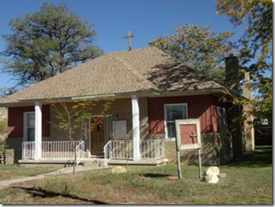
As you all probably know, Karin is Catholic and I’m not. However, I’ve made her a solemn promise to find a church wherever we roam, if it is within my power. Previously, such activity has hardly been noteworthy, but here in Utah, I find things on which to comment.
Arriving at Escalante, we are once again reminded of the relative sideline Catholicism plays in this part of the country. This is the local church, a converted house with a simple, unostentatious 2-foot-high cross precariously tacked onto the roof.
On the wall is a simple list of Mass times at various “local” locations (about a 150-mile circle); due to the hectic schedules and travel distances of local priests, the Masses in this region are held on Mondays.
GSENM
This is the commonly-used acronym for Grand Staircase of the Escalante National Monument, and I think I’ll use it going forward, just to avoid confusion about Escalanted (a town) and the Monument.
This is the first time we’ve visited the northern reach of GSENM, and the opportunities for exploration are overwhelming. Even the main 2WD roads are intriguing: Hell’s Backbone (up along the edge of one of the “stairs”), Hole-in-the-Rock (all the way down to Lake Powell), and many others. If you include the 4WD roads (we can’t this time), you could spend weeks exploring just this northern area.
We make an initial foray out onto Hole-in-the-Rock road, but its flat austerity doesn’t appeal to us just yet, and we reverse course to try out Hell’s Backbone. This leads us up out of GSENM and into Dixie national forest. The road is frequently washboarded, but not so bad that we turn back.
There are a few spur roads that lead to so-so camp sites, and we try out a couple of areas but eventually decide to move on. The road continues to climb up the mountainous terrain; Howie is turning in a steady 5mpg, rare in any of our travels. We climb, and climb, and climb some more. There are few turnouts, no camps, no views except deep forest. The only appealing pseudo-destination appears to be Posey Lake, about which we know absolutely nothing.
We make one wrong turn and have to perform one of Howie’s famous 36-point turns. It’s like your normal three-point turn, but with Howie’s length, it takes a lot of sawing back-and-forth to reverse course. Howie’s wheelbase is 14 feet, so with a LOT of patience and a low shoulder on one side of the road, I can hang the 10 feet of Howie’s “butt” over the edge of the road, go forward-reverse a few hundred times while madly swinging the wheel from lock-to-lock, and get the big boy turned around. This requires a roadway about 18 feet wide or more, giving me only 4 feet to work with.
No, it’s not really 36 points – – maybe 6 or 8. But it’s a lot, and each cut back and forth flirts with the risk of plopping a wheel off the road edge (a serious situation because it would “stuck” Howie straight across the roadway). So I err on the side of caution and do a lot of “sawing”.
Just a few miles later, we make another wrong turn, and go at least a half-mile before figuring out where we really need to be. This time, the road is only about 12-14 feet wide, no possibility whatsoever of turning around. I end up backing up for the half-mile, watching my left mirror to stay on the road and having Karin spot through the right mirror for traffic or obstacles. Touchy operation. I also discover that Howie’s cooling system doesn’t like air flowing in reverse; the engine temperature rises almost 30 degrees in the half-mile-reverse-uphill-climb. Phew!!!
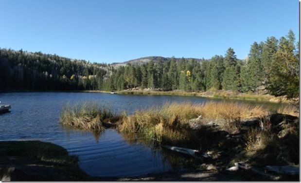
FINALLY (and well after Happy Hour I’m sad to say), we reach the Posey Lake area, and Lo! there is actually a Posey Lake campground. We are enthralled to find that the entire campground (30 sites) is totally empty, and apparently no longer “operating” for the season. No camp host, no fees, water shut off, etc. But open – – we have the Lake and the campground all to ourselves, a sweet little pear-shaped high mountain lake surrounded by pines and aspens. We even have our own boat dock and launch ramp for a foray with Beefor the kayak.
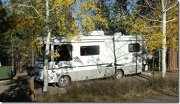 We park Howie in a nice flat site with a peekaboo view of the Lake about 60 yards away.
We walk around the area in absolute amazement at our good fortune. We’ve stumbled into what should have been a snowed-in camp, with several days’ forecast of good weather ahead. Karin is ecstatic, proclaiming already that our stay here will be extended indefinitely. She’s having a Super time and just can’t get over the beauty and serenity of this place.
Admission Fee
I guess there’s a price to everything – – in our case, the fee was wind and cold. When we arrived at Posey, the wind was murmuring through the tree-tops, a typical mountain-forest song. As the afternoon waned, the winds started to pick up. The murmur turned into a steady rushing. If we close our eyes, it sounds a lot like steady traffic on a highway.
As darkness falls, the ante rises. The highway traffic has become nearby jet traffic. It’s an odd feeling, because Howie is sheltered from any buffeting, by the very trees generating all the noise. There is no swaying and bucking like there was in the open-range desert winds of last week. The noise is even more impressive in this respect.
The winds produce a continuous, undulating roar that drowns out Howie’s heater and makes us raise our voices for conversation. By the time we go to bed, the Blue Angels are doing practice air shows in the campground, and Marine Harriers are hovering outside our bedroom windows. Lying in bed, mostly/sometimes sleeping, we smile and frown at the same time. We smile because we are snug and warm within Howie’s protection, and we frown because our idyllic little lakeside camp is showing its true colors. After hours and hours and hours of howling/rushing winds, we are sure that northern Utah is running out of air – – it’s all blowing past us down to the south.
At first light, the outside temp is 37F. It warms all the way up to 42 by 10AM. The winds have died off a little, but it’s still pretty obvious that paddling our kayak with all the fierceness we could muster might not get us past the boat dock by the end of the day.
We take a walk part way around the lake; Karin is able to go much farther than I am with my bum ankle. Nicer, but chilly. No idea if the wind it going to equal its performance of yesterday.
It appears our stay may be somewhat more limited than we initially thought. In fact, we’re getting the hell out of here today…

Comments
Fall 2012–Utah west — No Comments
HTML tags allowed in your comment: <a href="" title=""> <abbr title=""> <acronym title=""> <b> <blockquote cite=""> <cite> <code> <del datetime=""> <em> <i> <q cite=""> <s> <strike> <strong>