Fall 2012–Utah Canyonlands
2 October
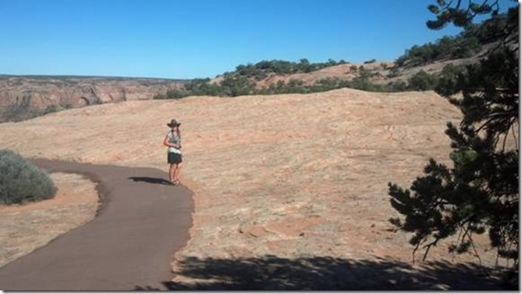
We travel through space and time today; sometimes it feels forwards, sometimes backwards. We leave the millions- and billions-year-old formations of Lake Powell, and arrive at the thousands-year-old habitat and ruins of the Pueblo Indians, the Hopi (Anasazi were farther east). This is high, dry country, and the plateau sandstone is very reminiscent of the glacially-scoured granite domes in the Sierra Nevada.
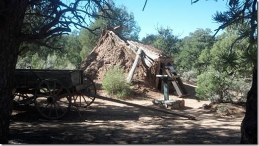
There are some really good exhibits here in the Navajo National Monument, including this hogan and a nearby sweathouse (Indian sauna).
The Indian ruins in this area are responsible for its Monument designation. They are well preserved but distant (minimum full-day hike to reach). Since we recently saw the Gila dwellings (last trip), we decide to view by telephoto.
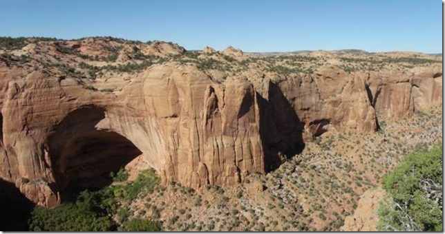
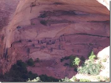
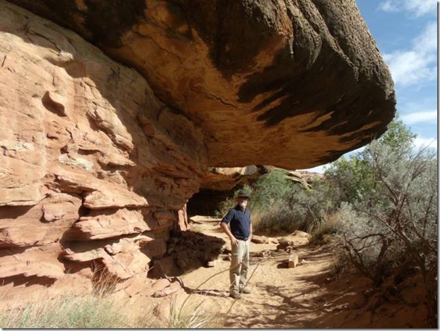
Just so you understand the scale involved here: that alcove, and the structures in it, housed 135 Pueblo ancestral people. They lived here, hunted and farmed the land, until a 20-year-long draught forced them out.
XV continued:
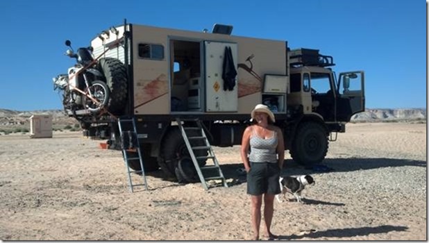
Before we left Page, we saw another expedition-type vehicle, owned and operated by a couple from Holland. They had bought a used military flat-bed truck, which had an RV-style “box” added onto it by its previous owner.
The truck was absolutely awesome, huge tires and drivetrain and massive metal and structures throughout. But it was nearly 18,000 pounds, got 8-9mpg on diesel at 55mph, and it was not clear that the driving-cab noise level was less than living inside a cement mixer.
In addition, the RV box had only a bed, dinette, and kitchen, plus storage. No toilet or shower (“Oh, we just wash in the sink.”)
Like us, they tote a motorcycle for local ground transportation. It levitates up and down via a swivel-crane mechanism.
3 October
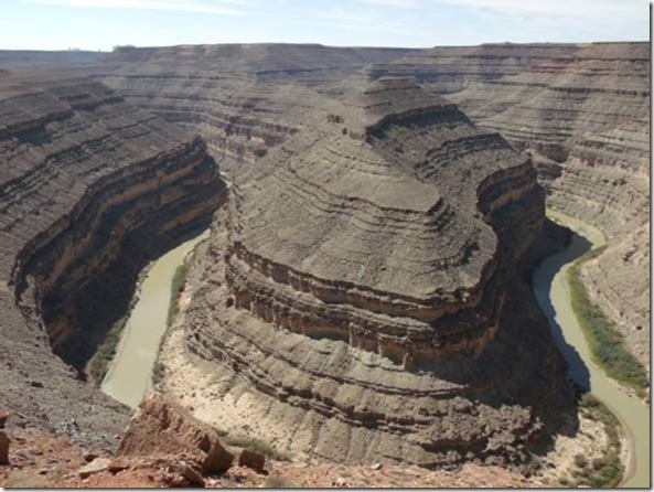
Leaving Navajo Monument, we head up towards an interesting feature, Goosenecks State Park in Utah. The goosenecks referred to are the twists and bends in the San Juan River. This is what’s called an entrenched meander; the river starts on a flat plain, and when the uplift occurs, the wandering channel persists.
Campground here is uninviting, stark and windy – – we head out again.
Departing from Goosenecks to the north on H261, the road signs repeatedly caution about over 10,000 pound trucks and “overweight” or “oversize” vehicles.
Well, we’re over 10,000 but we’re not a truck. And we think we’re about the right size….
Looking more closely at the map, we see that the highway which we originally thought to be continuous pavement has in reality a snarly little dotted-line segment. We decide to give it a try anyway, passing the Valley of the Gods B&B with mixed feelings….
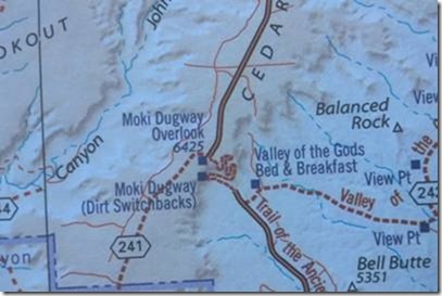
The snarly dotted-line road does indeed get dirty, rough, and steep – but it’s reasonably wide, the switchbacks are easily inside Howie’s turning radius, and there’s nothing really scary except the sheer heights and drops involved. (Actually, the Apache Trail near Phoenix was a worse road and far more demanding.)
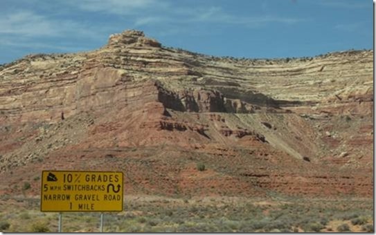
That mesa wall in the background actually contains the road that climbs and switch-backs all the way to the top of the mesa. We could hardly believe it.
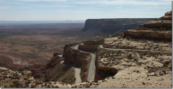
After three long miles, and several large vehicles passing VERY closely, we somewhat uneventfully get to the top. An English tourist in a rental RV gives us applause, for he has just driven it down and up in his towed car, and “the girls” have decided their RV will not attempt it.
We work our way across a vast, pinion-juniper forest and seemingly endless BLM land, heading toward the Natural Bridges National Monument. This land is so empty, but inviting as well, with many dirt access roads. Some of them are easily wide enough for Howie. However, sometimes even the paved roads are a bit tight.
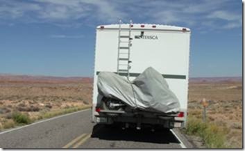
Above is an example of why we occasionally hanker for a narrower vehicle. The road lane is exactly 8 feet wide; Howie is 8.5 feet wide, plus one foot more on each side for the mirrors, which do NOT swivel out of the way. The outer edges of the tires are about 4” inside the yellow and white lines. The left mirror is well into the opposite lane, a truly exciting experience when passing a novice driver of a rental RV with the same dimensions.
This is not the tightest paved road we’ve been on; that honor is split between H58 east of Santa Marguerita, and H4 at Ebbet’s Pass in the Sierra Nevada, both of which are about 14 feet wide total. On Ebbets last year, we passed a 35-foot fifth-wheel being pulled by a 24-foot diesel truck. I’m not sure if two sheets of paper would have fit between us.
4 October
We had a pleasant, if not scenic, camp last night. Natural Bridges is a popular place, but with only 13 camp sites, and it filled up at about 3PM. We got the second-to-last, and a German foursome got the last one next to us. It was a dual site, so they were literally 4 feet away, very unusual but we decided to go for it. Friendly folks but they kept to themselves. They ran the generator for 15 minutes at 8:10AM, had their traditional coffee-and-toast breakfast, and off they went with a cheery wave.
We made the 9-mile drive, and the natural bridges (3) in the area were very easily viewed and quite impressive. They varied from small to massive, and one of them afforded an easy walk (200 feet elevation change in ¼ mile, about a 20% gradient).
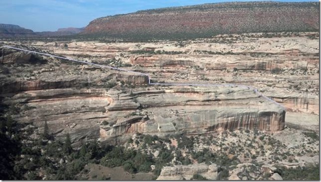
Here is an example of how difficult it is to distinguish between a near ridge and a far ridge; the blue line shows the upper edge of the near ridge, and allows the eye to determine where the otherwise invisible channel exists.
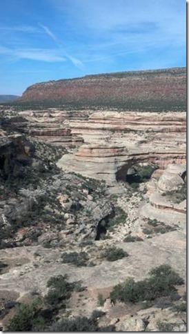
The first Bridge was a few hundred feet across, and difficult to approach (full day hike). In the available light, some of the Bridge outline is obscured by similar-looking background strata, so it’s hard to see the full bridge outline.
To get underneath this one, a 1.5-hour hike is needed, with a 600 foot elevation change. We drive on.
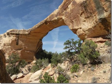
Later, the final Bridge on the loop drive was the thinnest, and most impressive.
After the hike back up to Howie, we departed for one of our principal destinations, Canyonlands National Park. We’re going to hit this large Park in several areas. The first connects out of Montecello, UT, a modest little town that happens to have the one liquor store that serves the entire county. We stock up on our essentials (tequila, triple-sec), and off we go on the 42-mile road to the NP. From Montecello, we have a choice to go further north and take a relatively flat, smooth road over to the southeast section of Canyonlands NP, or go straight west out of Montecello and drive a twisty but more scenic route. We elect for twisty. And, as it turns out, hilly. Like 10-15% hills, up and down.
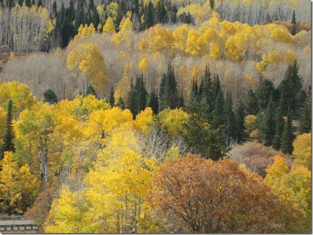
The aspens are in full Fall retreat, and we try strenuously to capture the grandeur of the mountainsides’ colors. Sadly, the sky is slightly overcast and the light doesn’t help us out much. But you get the idea:
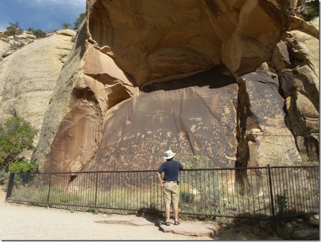
On the way to the Park is Newspaper Rock. Now, we’ve seen Inscription Rock in New Mexico, and we kind of expected the same thing, some ancient scratchings, hard to make out. Nope – – this place is amazingly well-preserved and the signage indicates that the best scholars of the day have yet to decipher what the various rock art means: from spiritual incantations to graffiti. We add our suppositions and wander on.
As we approach the Park, we make the acquaintance of a California couple who have been here before, and they warn us (quite accurately) that the Park campgrounds will be full. Checking in at the visitors’ center, indeed there is no camp space available. We elect to go slight backwards out of the Park and investigate a private campground ($20), a BLM campground ($7.50), and some dry-camp areas.
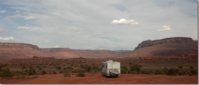
As it turns out, the free spots are outstanding, and we and the other couple pick a pair of camp sites for the night. Not too shabby – – and this is the BACK side of the view. The main Canyon is to be revealed tomorrow.
5 October
A Remarkable Day
Exploring the Needles portion of the Park today, we see so many different sandstone landforms of such infinite variation – – it’s clear that neither pictures nor words can convey the diversity of what we are looking at. Here’s a shot of the “needles” skyline.
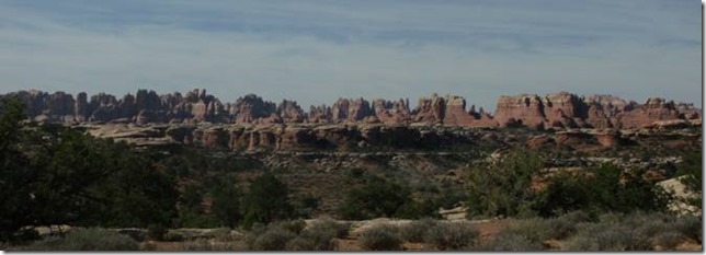
The whole area is remote, 40 miles from the nearest “main” highway (H191), and the road access is limited, about 9 miles of pavement to look around. But there are hundreds of miles of trails and 4WD roads. And here arises a peculiar curiosity: the Park literature repeatedly says stuff like “rough 4WD” and in one section “4WD roads to challenge the most experienced enthusiast”.
Okay, if you run across drivel like this in most US publications, you can read between the lines and figure, yeah, it’s a rough dirt road with some ruts and may a dip across a runoff channel. BUT – – as we subsequently learn, this section of Utah is pretty much the 4WD and off-road capital of the western US. They’re used to people with 8” suspension lifts and 44” tires and quad lockers and all that extreme stuff. And, as we very soon learn, “rough” means ##?!&% ROUGH. (Replace code with adjectives and/or expletives of your choice.)
The first thing we tried, in terms of exploring the non-paved back country, was Elephant Hill. After looking at the first 100 yards, we thought seriously about just going back to camp and sipping Margaritas while petting tarantulas and Gila monsters. Safer.
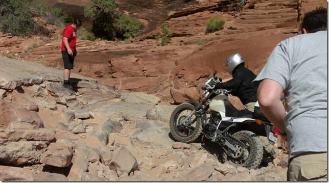
But NO, Mr. Macho had to try it out. Dang. That first stretch is so loose that there was just no traction or balance to be had. Some guys that were trying to coax a 4×4 up the trail, helped me through the loose stuff onto some solid rock and I made it to the first switchback level.
BTW – – just for reference, Elephant Hill is a scant ¼ mile long (just over 1000 feet), and rises over 250 feet in that distance – and average 25% slope. There are some flatter areas, and a couple of near-100% (45 degrees) pitches.
After the first panic attack, I kind of get the idea, and I’m off the seat, on the pegs, and that little 200cc bike’s low-end torque is really making pretty simple work of all the rock. Aside from the adrenalin shooting out of my ears, the rest of the ride to the top is grand ride. Karin, of course, has to walk the whole way, but that’s fine with her for sure.
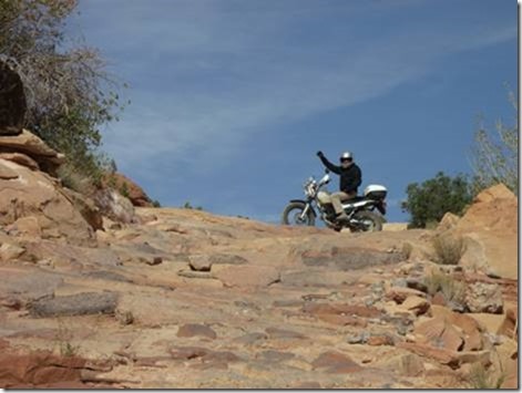
So now, we’re at the top, we look around, and the way to continue is just as bad or worse than what we just traversed. I’m thinking, let’s not push our luck (Karin again agrees), so I face the inevitable consequence of my excesses and adolescent judgment: now I must go DOWN. Oh dear (that’s not what I actually said).
Down is always worse on a motorcycle, because the consequences of any fall are about 3-4 times worse. Speed is higher, gravity is working in favor of injury, and the descent angles are such that the front wheel can cramp sideways out of the rider’s grip, and pitch the poor soul over the handlebars in a swan dive into agony. This is such a common threat/experience amongst riders that it has its own charming name: the Endo. As in end-over-end. As in “end o’ the world as we know it”.
More adrenalin, intense focus, and more delightful handling of the TW200. Except for walking the loosey-goosey part, I manage to safely roll/bounce/balance the little beast all the way to the bottom, without even putting a foot down.
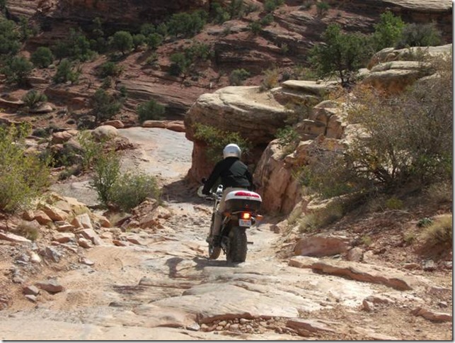
After this relatively harrowing experience, we decide to cool it for the rest of the day. We make some delightful paved and dirt-road side trips, including a really nice hike around Cave Springs, which has some impressive water-scoured overhangs to make you wonder when they are going to drop into the stream bed.
As the end of the day approaches, we go out beyond our camp site for an exploration of just a short stretch of the 48-mile dirt road that runs all the way up to the next section of the Park.
This road is all on BLM land, and BLM land in Utah is the boondocker’s paradise. Mile after mile of pullouts and camp sites, all beautiful and rugged, all for free.
Papoose Predictably Projects Puerile Passengers in Pile
As we wind our way along pretty easy roads, we find the occasional rocky section or rutted area. The we cross a stream bed and deal with some sand. As we climb up the opposite bank, what should have been a hard-surfaced side-slope turns into a deep-sand section about 50-100 yards long. The kind of sand that you sink into to your calves just standing in it.
Having survived the perils of Elephant Hill solely on the merits of my own testosterone, I quickly decide that we are too tired to walk through all that sand, and I throttle up for a quick traverse.
Hmmmm, boy that bike is wallowing quite a bit and Uh-oh it’s doing some tank-slapping too (handlebars pushed by the sand to extreme ends of motion). Oh, gee, guess what the bike is going down and we are going down with it and my isn’t that sand soft except why are my body parts moving in all those strange directions and who is trying to tie that square knot in Karin and my legs and oh are we finally stopped now?
If it didn’t hurt so much, it would be more laughable. But it’s pretty laughable anyway. The bike is lying on top of me and Karin. As we went down, I felt my left leg being twisted clockwise what felt like 2 or 3 full turns. Karin got the same thing, but maybe only 1 or 2 full turns. Neither of us can get out from under the bike quickly, so we squirm and twist and gradually push sand out from under us until we can stand up. Well, sort of. Karin’s pretty good except for a jammed thumb, but my left ankle is shock-numbed.
Sad to say, I do know from experience that my left leg is not going to be good for much in about 15-20 minutes. So we hoist up the bike from its downhill lie, get it turned around, and start riding back to camp.
By the time we’ve gone half the 5 miles, I can no longer lift my left toes to shift. We ride the last few miles with me using the back edge of my heel to upshift.
When we get to camp, I can’t get off the bike, ‘cause only one leg works anymore. Karin is, as usual, and absolute Princess and helps me get into Howie. We clean up and rest for a bit.
I find that I have a lot of torn-tissue kind of pain, but none of that deep-ache sort that goes with broken bones (don’t ask me how I know all this). So I manage to put enough weight on my left foot that I can limp around a bit, grill some dinner, etc.
We are both REALLY tired (big surprise) and we go to bed early. The first half of the night is pretty uncomfortable for me, and my ankle swells up some. Later on, the pain becomes a little more tolerable, and I actually sleep for a while.
6 October
Readjustment Day
I can walk, sort of. Carefully. Not far. My ankle looks like it’s been eating jelly donuts, very plump. My mood is great and so is Karin’s. We’ve talked about the possibility of a bike crash, many times, and now it’s happened, and we’re moving on. I chat for an hour with the guy from California about vehicles, expenses, risks, requirements, and compromises. All of course exquisitely flavored by recent events. I’m actually having a pretty good time. Wince.
Clearly, the trip is not wrecked, but certainly changed some. We’ll head to Moab and see what’s next.

Comments
Fall 2012–Utah Canyonlands — No Comments
HTML tags allowed in your comment: <a href="" title=""> <abbr title=""> <acronym title=""> <b> <blockquote cite=""> <cite> <code> <del datetime=""> <em> <i> <q cite=""> <s> <strike> <strong>