Fall 2012 – Utah
“But it’s a DRY heat….”
Well, true enough, but at 92F we were measuring our pace carefully as we hiked around the old Paria town site. That 92F in the daytime is followed by a night that drops to 44F just before dawn: a 48F temperature swing, with no weather fronts or any other prompting!!! Welcome to the desert….
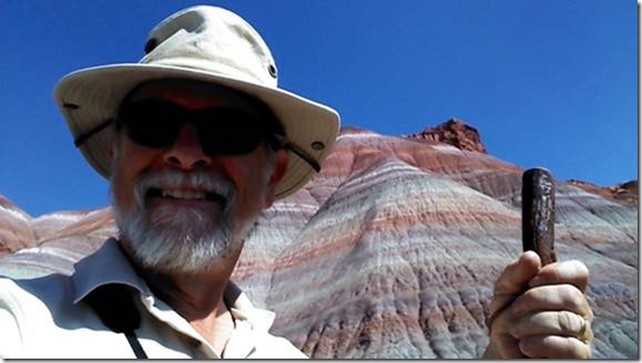
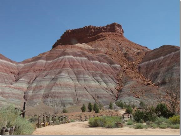
We had driven east out of Kanab (after fixing the fridge burner and the knocked-off leveling jack pad), and exited H89 to go to the gorgeous Paria River canyon. There used to be a town site here, but it got flooded out in 1878 or so. Then a movie set was built, and IT got flooded out. Someone re-built the movie set on higher ground, and it was subsequently torched. Seems that buildings and such just aren’t too welcome around here.
Met a couple of BLM volunteers who told us to camp anywhere, and we did, in a nice flat spot just where the already-challenging road started to get worse.
Later, a Ranger stopped by, nice gal, and told us we could get a citation for parking where we were overnight. We were nice (and contrite) and she allowed us to stay – – but later, we saw a better spot, and a legal one, and moved anyway.
Turns out there’s tiny little road-side stakes that say “No Camping”, and what they mean is that there’s no camping between the stakes. Live and learn, free lesson. All of this minor stuff is well-paid-for the by immense physical beauty of our location
We’ve gotten quickly used to our travel/leisure status, and the time just flies on by. One day we hike, next day we read, wow breakfast lunch dinner sleep and what day/date is it? We have to check our phones to be sure….
We’re being so frugal that our water supply is lasting for probably 10 days. Our solar system is absolutely bustling in the late summer sun; our batteries are at 100% by early afternoon.
The fridge is still a bit anemic, having great difficulty pulling down below 45F-47F even in the cool of the evening. So we face the possibility of having some food spoil, but maybe not. We’ll see.
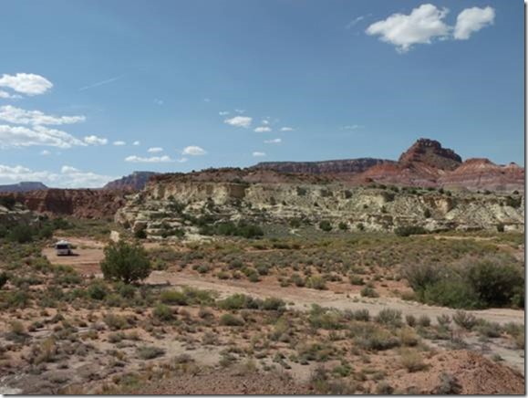
It’s a fabulously beautiful spot, marked by an almost indescribable number of colored layers of sedimentary deposits, all worn away by wind, water and time. From our campsite, there is no direction to look that doesn’t have a spectacular view.
Not terribly crowded either, with maybe 8-10 cars a day meandering slowly past. Seems like half the people we meet are German tourists, so Karin gets activated and I struggle with my primitive German and we all have a good time.
We’ve been reading up on our new e-books, the “Frugal Shunpiker’s Guide” series (don’t ask me, just look it up). There are some superb opportunities in the areas above the Grand Canyon and below the Utah border – – an isolated, once-lawless band of land known as the Arizona Strip. We are going there next, even before we further explore Utah, because it is only a short back-track to Kanab and down H89 Alternate. After the Grand Canyon, we’ll get back to the business of exploring more-eastern Utah, like the Canyonlands NP and other fairy-tale landscapes.
Tomorrow morning, we’ll launch out of here and attack the fiercely steep entrance road. Hopefully Howie will not have a big problem with the gravelly, rutted road we carefully crawled down. I’m a little concerned about the engine temp, so we may have to climb out in stages, we’ll see.
Then we’ll go back west on H89, gas up in Kanab, and take H89A, then H67, down into the Kaibab forest and the Arizona Strip area. Our present plan is to camp at a place called Timp Point, just west of H67 on gravel roads. Our information is that undeveloped/boondock sites are to be found 50 yards from the Canyon rim. We’re excited.
However, it’s about 130 miles of fairly slow roads, plus getting gas, maps, and any other critical (?) information and provisions, which means we’ll be traveling most of the day.
18 September
How Good Can it Get?
The ghostly crescent moon points its silver bow at the setting sun: “Goodnight, old friend, see you in the morning; I’ve got the night shift.” Just outside our doorway, the hazy vastness of the Grand Canyon stretches out past the imagination. Fifty steps away, the north rim drops precipitously away from our campsite. And it’s free, and we are alone. We’re in the Kaibab NF (of which there are many different areas), the section just above the Grand Canyon in what’s called the Arizona Strip.
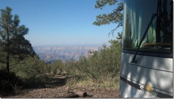
The day has been spent traveling, planning, talking and studying maps and guidebooks. At a Ranger’s suggestion, we take Forest Road 22 instead of Highway 67, and after 53 miles of paved and dirt roads, we arrive at Timp Point. The last 25 miles have been varied, from smooth 35mph fire-road to axle-pounding, 5mph rutted track. And washboard – – – – let me say a few words about washboard. Hmmmm, the first 30 or 40 words that come to mind are profane, so let me re-start.
![]()
Washboard is a road surface that resembles the traditional rippled surface of a hand-washing board used to scrub laundry. A typical washboard road surface is caused by the natural bounce of vehicle tires, gradually building up small, soft ridges of sand and gravel. These ridges are rarely more than one inch deep, and 10-15 inches apart. No big deal, you’d think, looking at them. Wrong. This seemingly minor fluctuation is inherently designed to drive suspension components full-travel, simultaneously disassembling entire vehicles, distributing used, worn-out parts along the wayside, and driving sane men irrevocably mad.
At first, the vehicle simply rattles a bit across the surface. Then, at the critical (resonant) speed, the suspension and the ripples come into synchronization. Tires, wheels, and the entire vehicle begin traveling up and down vertically in what seems like several feet at a time. The driver and passengers experience the terrifying sensation of the impending end of the world as they know it. All sounds immediately are amplified by 100 times, and the gut-wrenching apparency is that the vehicle will soon be separated into several thousand parts flying off in the general direction of Pluto. An immediate effort to slow down, obviously by applying the brakes, incredibly only makes things worse. As the vehicle slows through the critical resonant speed, seismometers at Cal Tech fly off-scale. Dental fillings begin to fall out, vision blurs, and the driver’s grip on the steering wheel leaves permanent finger grooves. Passengers’ screams have been known to shatter the safety glass.
When it all finally comes to a silent stop, the occupants are amazed to find that they still live and breath, the grass is green, the sky is blue – – and only the missing exhaust system or bumper assembly lying by the roadside brush is evidence of the ordeal.
We had quite a bit of mild-to-fair washboard on the way in. Howie took it all bravely, although at either 5mph creeping along, or a horrifying 30mph plus (above the rattle speed), in the hope that the road smoothed out before we had to slow down for a turn or a pothole. By the time we arrived at camp, all pieces were still attached. We cleaned up the miscellaneous debris strewn about the floor and continued to really enjoy ourselves.
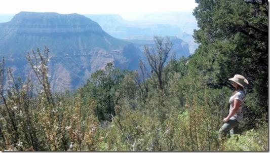
This area is not the well-groomed tourist pull-out in the National Park. This entire north-western rim area, about 25 miles or so and 9 different road-end points, is devoted to “primitive” or “dispersed” camping, official Forest Service descriptions that define a no-facilities type of environment. In this place, there are no picnic tables, no water, no toilets, for sure no pay-showers or dump stations. Absolutely no swing sets for the kiddies, and also no 3G/Internet. There are flat spots and there is Nature at its undisturbed finest.
Our nearest camp-neighbor is about 200 yards away to the southeast. The next one (we met on a trail) is 3 miles to the northwest. There is a feeling almost as if the Canyon belongs to us privately.
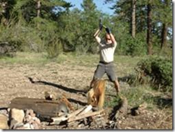
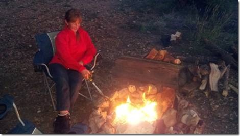
After finding and cutting up some firewood, a fine stove-cooked meal (BBQ tomorrow night), we stoke up a small fire and enjoy the cool evening.
19 September
Exploring
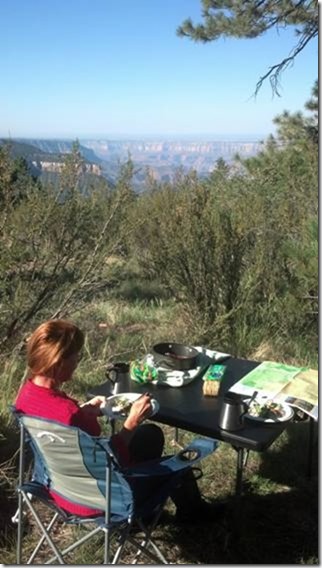
Breakfast is against the backdrop of the Canyon; haze has not yet obscured the formations and the distances….
We spent most of the day today buzzing around the back roads on Papoose. Our little Yamaha TW200 is a bit of an enigma. We’ve outfitted him with lots of bells and whistles, and it’s a nearly ideal combination. When Papoose is riding on Howie’s back, he’s invisible, and costs us no mileage or maneuverability issues at all (like a towed vehicle would).
We dismounted Papoose today, amidst a cloud of caked dust accumulated from 35 miles of dirt roads. Cleaned up the mirrors, windshield, seats and whatnot and launched on down the myriad roads of the Kaibab forest. Potholes? what potholes? Washboard? Who cares? Lower back? hmmmm. Prostate? hmmmm.
Nevertheless, 30 rough-road miles later, we have a pretty good idea of this portion of the North Rim. Most of the “points” are fairly similar. All are remote, unpopulated, pristine, and worth the trouble to get to. The roads which go out to the “points” are mostly ridge-running roads, and fairly level with only occasional rough or muddy spots. The north-south connecting roads (FS250 is an example) are something else entirely. These run down into the drainages between the point-ridges, and have steep, rough, rocky, rutted descents and climbs. The FS250 road is difficult for Papoose, impossible for 2-up (Karin walks the tough spots), and unimaginable for Howie.
After several hours of exploration, we find that the various viewpoint/camps are somewhat similar: North Timp, Locust, are much like the Timp camp that we occupy. So we decide to stay put and enjoy the next few days.
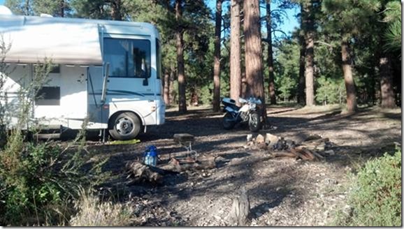
Our proximity to the vastness of the Canyon has an emotional effect. Even when we can’t see it, we know that the enormous empty space is there, and it affects us. Moreover, the isolation and peacefulness of our site is compelling as well. For two days now, we’ve seen a total of 4 hikers and one vehicle drive-by from our camp. On our 30-mile exploration today, we passed not ONE single vehicle in either direction for the entire trip.
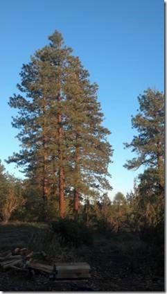 Initially, we saw the camp-side brush and rough country as obstacles to being able to view the Grand Canyon. Now, we feel that it’s an “admission pass” to be a part of this rugged, immense country. We have a sense of the time of Fremont or Powell, when they wandered through here without the benefit of paved overlooks with caution signs.
The evening sunset shines a golden illumination on to the lovely bark of the Ponderosas, and we light up a fire and watch the day fade.
As night falls, we sit by the fire and watch the moon, stars, and Milky Way drift across the sky. There is no sound except the crackling of the fire and sighing of a gentle breeze.
20 September
The Arizona Strip
As we continue to enjoy this amazing bounty of idyllic weather, sublime surroundings, utter peace – – we are profoundly aware of our remoteness. Musing over the history of this area, we recall that (in bygone days), the Arizona Strip was a desolate, lawless melting pot of criminals, ne’re-do-wells, outlaw gangs, and fugitives. Why here? Simple geography and politics – – the Strip is bounded by the untraversable Grand Canyon on the south (geography), and the AZ/UT border on the north (politics). Since it was Arizona territory legally, any law enforcement had to come from the main Arizona manpower, largely out of Phoenix or Flagstaff. Travel to the North Rim took literally days to accomplish, was attempted by few men hardy enough for the round-trip journey, and even fewer inclined to confront a band of armed sociopaths on their home ground. Likewise, Utah law enforcement, although “only” 80 miles north in St. George, was not going to spend money and risk lives going south of their jurisdictional border. It was a no-man’s-land in the deepest sense of the term.
The legacy of lawlessness is gone today, but the remoteness and isolation remain, with few amenities. There are no Home Depot stores, actually not even a medium grocery store, no liquor, no hardware, and very few paved roads, for the 300 miles or so between Kanab and Page. Our kind of country, and we are enjoying it immensely.
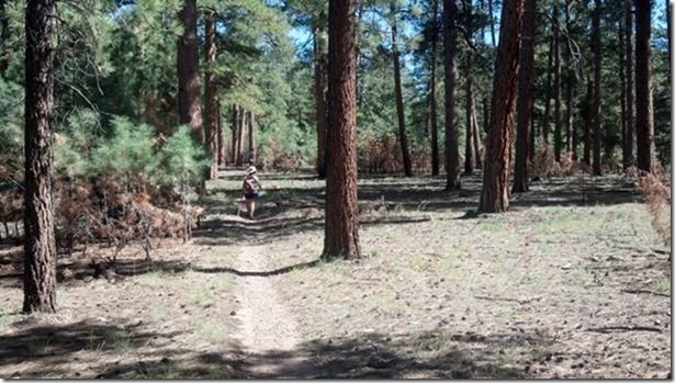
Hiking and/or driving the area, we find so much beauty. The Canyon always impresses, of course, but the forest has its own charm.
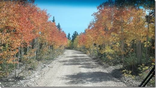
We travel through quaking aspen groves in various states of Fall colors.
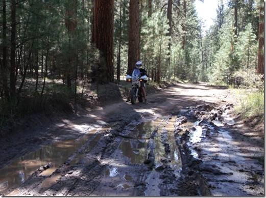
We also encounter the occasional road-hazard…
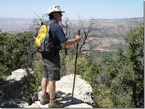
… and the amazing hiking gift at a turn in the trail.
21 September
“Civilization”
It’s getting near time for a “utility day” – – laundry, dump/fill, groceries, Internet. So we regretfully leave our marvelous camp, and bounce out the 20 miles or so of dirt road back to the lower stretch of H67.
DeMotte campground (USFS) is right at the end of the dirt road at H67, about 5 miles above the Park boundary, very spacious and clean and cheap ($8.50/night). Of course, this is now the weekend, and spaces are filling up with not-always quiet and peaceful campers. The still air and quiet surrounds carry voices, dog-barks, and childrens’ cries to the far corners of the campground. Our peace with this comes, not from inner calm, but from the knowledge that we are leaving in a day or two, so just suck it up, okay? We’ve been in camps with folks with good manners, and we’ve been in camps with really rude thoughtless people. This one is (so far) in the medium-to-good category. Sadly, our next-door neighbor is a big fat woman with a very loud voice, who chooses to shout at her tiny daughter who is 3 feet away from her. Ah well, “this too shall pass”. Nothing can seriously subtract from the fine time we are having.
Down the road, the National Park holds the tourist crowd proper, with lodges and gift shops and jammed parking lots. Our senior pass gives us free access to the Park, the fill/dump site, and other minor facilities. Interestingly, even though this is one of the more remote NP establishments, the campground is booked solid for the entire season, 6 months in advance. Extemporaneous travelers like us have no chance. Our camp, however, at DeMotte, is only 18 miles from the Park lodge, and even with Howie’s horrible mileage (8-10mpg), we still can use him to commute to the Park attractions, which we will do for the next few days.
Internet is VERY scarce to non-existent. On the Timp Point rim, we had a tenuous cell-phone link, but what do you expect when you’re that far out?
but here in Tourist Central, there’s not even a cell phone link, much less 3G. I’m hoping to send off this update at the Park tomorrow or the next day, by taking the laptop out to the front porch of the lodge, where either 3G or Wifi should be (thinly) available. After that, it will be another week before we reach Page for another connection. We are still debating whether to take a Canyon mule ride or not, but probably will do so on Sunday.
22 September
It’s Fall Now for Sure
Outside temperature went to 32F last night, and the cabin was at a snappy 48F this morning. We gave in and turned on the heater. Bliss.
Back at Tourist Central, the much-vaunted wifi is dead or non-functional at the campground store. Everybody seeking signals on the front porch gets up and leaves in disgust. I’ll sit here for a bit and finish this day’s notes, with Willie Nelson crooning over the store sound system. Later, I’ll go over to the Lodge, to try for connection. I had a faint 3G signal yesterday… Karin’s off reading her book(s) at the Laundromat. Tomorrow we plan on a half-day mule ride to catch a glimpse of the Canyon, if not from Powell’s perspective, at least from well below the rim.
This issue of my little travel newsletter is much larger than I expected it to be, what with the extra time, cool stuff to write about, and what not.
Hope you enjoy,
G.

Comments
Fall 2012 – Utah — No Comments
HTML tags allowed in your comment: <a href="" title=""> <abbr title=""> <acronym title=""> <b> <blockquote cite=""> <cite> <code> <del datetime=""> <em> <i> <q cite=""> <s> <strike> <strong>